Sunday, September 10, 2017

Hiking the Moose

The views stretched for...feet today...
It had been a couple weeks since I had taken my pup on a hike, so I knew he would primed and ready for a big day. I decided to take him to one of my favorite peaks in New Hampshire and what would be his biggest mountain to date, Mt. Moosilauke. Having hiked it via the Gorge Brook Trail at the start of my quest to tackle the NH 4000 Footers back in 2014, I wanted to try a different route to the top, so I decided upon the approach from the Glencliff Trail to add in the South Peak summit I had yet to visit.

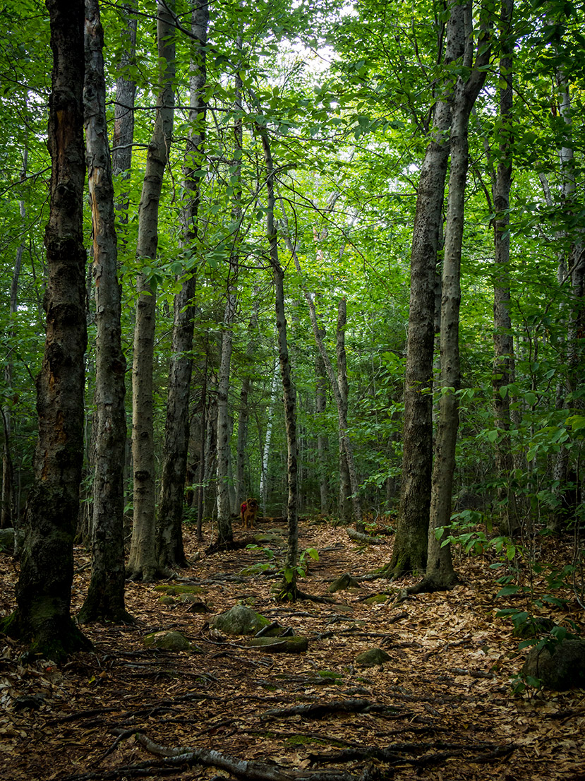
We started a little after 8 a.m. up the Glencliff Trail parking area. This is same route northbound AT hikers take as they head into the heart of the White Mountains. The beginning conditions were as good as I could ask for on such a well-used path. For the first mile and a half the trail was almost completely dry with easy, soft footing and only a spare root or rock jutting out of the ground here or there. The grade at the start was mostly moderate with a few steep pitches that made my pup and I have to catch our breath before continuing.

At about 1.5 miles in we reached a couple brook crossings that then gave way to a wetter, muddier, rockier, and..."rootier?" (we'll go with it) trail. In several spots the footing was squishy at best, and it seemed that every rock and root on the ground had just enough moisture on it to make every step a slippery decision. The stretches of soft ground from earlier had given way to a relentless battle of stepping on, over, and in between all these obstacles that were to be our trail for most of the rest of the way up. Even as we reached a long stretch of little elevation gain, having to meticulously plan each step subbed in as a new annoyance.

About 2.5 miles in we reached the stretch of trail known as "The Agony," (knowledge nugget from Stephen D. Smith's NH 4000 Footer Guide) and we quickly learned how well-deserved that name was. This half mile full-on ascent was a rocky rampart with little relief along the way. It was the steepest stretch of trail the whole day, composed mostly of large rocks and boulders. It was like climbing a collapsed, jagged staircase from a not-so-funhouse. We were happy to leave it behind once we reached the junction with the Moosilauke Carriage Road 3.0 miles into the hike.

Up in the alpine zone
At this junction there is also the short spur trail to the South Peak, but I decided to save that for our return trip back down. Therefore, it was up into the alpine zone and onto the main Moosilauke summit. Up to this point it had been a mostly sunny hike, but during this 0.9-mile stretch the clouds and wind descended upon us, limiting our visibility to only 100 ft. or so in front of us. I made sure my pup stayed in close range ahead of me as the scrub trees gave way to the completely bare home stretch to the summit sign. This section of the trail was a relief after "the Agony" with only about 300 ft. of elevation left to gain over that 0.9-mile run. It was still muddy even in it's flat stretches, but the rockier portions of this trail were dry and easy to navigate. Being an old carriage road, it was weird to see such wide sections of trail so high up in the Whites!

New highest summit for this guy!
The summit was a blustery blanket of clouds which my pup enjoyed much more than me. We only spent enough time for me to snap a picture of my furry friend on his new highest summit hiked before we headed back into the scrub trees for some relief from the wind.

I appreciated the orange trail signs on a day like today
Before heading back down the Glencliff Trail, we took the 0.2-mile spur path over to the South Peak summit. This trail started as a soft, damp stretch of mud before entering a quick, steep, rocky push to the top. It was a very tight single-track ascent, made ever more enjoyable by another calamity of rocky steps forming the climb while conifer branches snatched at me and my trekking poles.

We had a little more luck with views at the South Peak, with a few distant mountains briefly poking in and out of the clouds rolling by us. My camera sadly deleted the pictures I took of these peaks, but know that the views here were better than its higher counterpart.

A wee bit blustery on the South Peak. I had to keep my hat from flying into the valley below!
After taking in the South Peak for about 20 minutes we headed back down towards our car. Having dealt with so many stretches of soggy trail, the descent was just as rough as the climb to start the day. At this point, the bottom of my hiking shoes were more mud than tread, making for slippery steps on roots and rocks the whole way down. I was happy to reach the dry, soft trails we started the day with to give my feet and knees a break as we trekked towards the parking lot.

Some nice limited views on the home stretch
Minus losing the photos I took and the lack of views from the main summit, it was good day up in the Whites. When we got back home, my pup was ready to head outside again, so apparently 8 miles of hiking and 3300 ft. of elevation gain wasn't enough to wear him out! Having now taking the Glencliff and Gorge Brook Trail to the top, I definitely prefer the Gorge Brook for its more moderate ascent. The next time I head up to tackle the Moose, I bet I'll be taking that one again.

Here are the time breakdowns for our hike:
  • Start at Glencliff Trail parking area - 8:05 a.m.
  • Junction with Moosilauke Carriage Road - 10:18 a.m. (3.0 total miles)
  • Moosilauke summit -  10:50 a.m. (3.9 total miles)
  • South Peak summit - 11:25 a.m. (5.0 total miles)
  • Left South Peak summit - 11:45 a.m.
  • Back at Glencliff Trail parking area - 1:41 p.m. (8.2 total miles)

Tuesday, September 5, 2017

An Epic Day in the Clouds: Tackling the Bonds

Sometimes the views don't make the adventure. That was certainly the case for my brothers and I as we set out on a 15.4 mi. trek on Sunday to knock out four official NH 4000 Footers (Zealand, Bond, Bondcliff, and West Bond) as well as Mt. Guyot.

Our journey started from the Zealand Falls Hut where we had arrived the night before for a two-night stay after hiking in over Mt. Hale. During breakfast, we were anxious to hear the latest weather report from the Mt. Washington Observatory to see how bad the outlook was for the day. We knew from checking forecasts prior to hiking into the land of no cell service that Sunday was looking sketchy with some moderate to heavy rain and strong winds expected. We were happy to hear the hut croo say that the heaviest of the rain wasn't expected until the evening. We decided we had the window of opportunity we needed to get in all the peaks, so we finished up breakfast and set off from the hut around 8 a.m.

We could see the clouds starting to thicken in the sky as we stepped out of the hut and took in one of the few good views of the day. The sun was still showing through and cast a wonderful light on the first signs of fall down in the valley. From there, we began the steep trek up the Twinway Trail. Going in this direction, we were headed southbound on the Appalachian Trail and gaining a lot of elevation over not a lot of mileage. We passed several thru-hikers headed for Crawford Notch along the way. It was a steep, (dry) rocky climb for most of the way until we came to the crest of the Zealand ridge and headed for the Zeacliff viewpoint. We got there just in time to take in our last view of the day with the White Mountains stretching out all around us and the clouds gathering with ever increasing speed.

Our best view of the day from Zeacliff
From the viewpoint we continued on the Twinway Trail along the ridge now gaining elevation at a much gentler pace. The trail had smooth easy footing by way of bog bridges, smooth rock faces and single track dirt runs for a good portion of this section before becoming increasingly steeper and rockier as we headed up to the side trail for the summit of Zealand.

It was at this point that the winds also picked up as well, causing us all to add an extra layer to battle the gusts that would be bothering us for the rest of our trip. The clouds also descended upon us as well and became part of our path the rest of the way out and back.

Ladder heading up the Twinway Trail to Zealand (Photo credit: Paul Vinson)
The final climb up to Zealand was probably the easiest ascent of the day, both because of its gradual elevation gain and it was the point our legs were at their freshest. The side trail to the summit was well marked with a small cairn and a sign on a tree pointing us the right way. Going the direction we were headed you can't miss it. We quickly headed over to the summit to bag peak number one for the day, and then it was on to Guyot.

From the summit of Zealand the trek picked up in strenuousness as it was a steep drop off the summit followed by a steep climb up to Guyot, almost like hiking along the letter "V." There were points along this section we had to get on all fours to clamber up rock slabs and keep our balance along sections of the trail that were just rocks piled on more rocks.

When we broke the treeline at the Guyot summit, we were finally hit with our first truly strong gusts and wet weather of the day. As we turned left to head down the rough, rocky start of the Bondcliff Trail, we were bombarded by winds so strong that we couldn't hear each other without shouting even when standing side-by-side. We couldn't tell if the water smacking us was rain or just the moisture in the clouds whipping by, but either way, we would be getting damp the rest of the way.

Once we got back into the trees the descent was quick down past the Guyot campsite and trailhead for West Bond (we decided to save that for our return route). The climb up to our high point of the day, the summit of Mt. Bond, was a gradual rocky approach, now a little slippery with rain starting to fall. The winds on the summit of Bond were stiff and made our stay up there brief. The mix of the wind and rain made the chills set in quickly whenever we took a respite above treeline, so we tried to save most of breaks for warmer, more wooded sections of the trail.

My older brother, Paul, descending Mt. Bond onto the Bondcliff ridge
Once over Bond we steeply descended onto the Bondcliff ridge, coming out of the trees onto a very slippery, rocky welcome to full exposure. Everything on the ridge was well soaked from the rain and winds. We had to keep our tired minds focused on following the cairns and finding good footing, but we all slipped and stumbled a few times. Luckily, none of us got any injuries along the way.

My brothers working their way along the ridge
The thick cloud cover hid the iconic cliff of the Bondcliff summit well, and we falsely hoped we had reached the summit several times, only to see another, higher section of the ridge appear before us. After three or four false summits, we were finally rewarded with a view of the cliff on our right and climbed up onto the summit to cap the furthest point of our adventure.

This is as close as we were getting to the cliff with those winds! (Photo credit: Paul Vinson)
 On our way back to the Zealand Falls Hut, all of our trails were now soaked and sopping wet. The side trip to West Bond was a quick twenty minutes each way, and the winds on its exposed summit were probably the harshest we felt during the entire trek. We trudged over slippery boulders, thick mud, deep puddles, and ever increasing rain until we finally returned to our starting point at the hut, ducking under the porch just as the clouds really let loose a downpour. All told we completed this hike in 15.4 unbelievable miles in 9 hours and 45 minutes, crossing the 5 mountains along the way a total of 9 times. We arrived back at the hut a mere 15 minutes before dinner service, soaked from head to toe.

With the mix of the terrain and the weather, this was the most challenging hike I've taken on in my quest to summit all of the 4000 footers, and I am so happy my brothers were part of this chapter. I wouldn't have picked this day to hike these mountains solo, but the three of us now have an amazing story of unbelievable accomplishment we will most certainly look back on every time we get together.
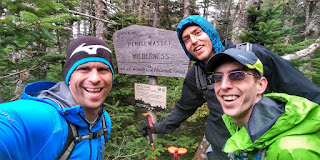
Photo credit: Paul Vinson

Monday, August 28, 2017

Owl's Head: Living Up to It's Reputation

The start of a very long day...
I figured I'd put off this mountain long enough. With one more mountain to go for halfway through the New Hampshire 4000 Footers, it was time to knock Owl's Head off the list.

I set off early Sunday morning for the Lincoln Woods Trailhead off of the Kancamagus Highway. The lot was about 75% full when I arrived around 8 a.m., but I figured most of those people were overnighters or car spotters from Saturday. As I got deeper into my hike, I was reassured that very few were there for the same long out-and-back trek I had in store.

One of several nice viewpoints along the Lincoln Woods Trail
I started up the Lincoln Woods Trail for the first 3 miles of the 18.4 mi. mammoth round-trip hike to Owl's Head. It's wide, flat, easy grade made for a pleasant start on what was a bit of a chilly morning for late August. It felt like fall was getting an early start up in the mountains. The trail was completely dry and in fine shape. The viewpoints along the Pemigewasset River-East Branch were some nice first views to take in as I headed deeper into the Pemigewasset Wilderness.

Into the wilderness I went, withe Franconia Brook Trailhead just up the trail to the left
 My first little bit of elevation gain came when I reached the boundary for the Wilderness area and subsequently the trailhead for the Franconia Brook Trail. It was a quick, moderate rise up to yet another long flat stretch of hiking deeper and deeper into the forest. Along this trail I got my first short stretches of "mud cake" trail. Nothing that couldn't be avoided along the edges, and still nothing damp either, which was what I was hoping for with it not having rained significantly in the area for over a week. There were a few stream crossing along this trail, but none very wide and all easily done by hopping across a couple rocks.

Deeper into the wilderness still
The Franconia Brook Trail went by quickly and then it was on to the more interesting parts of the hike as I started the stretch along the Lincoln Brook Trail. This trail started similarly to the Lincoln Brook Trail, with a easy, steady, moderate rise until about a half mile in, where I finally came to the first of the two big stream crossings so often referred to as "difficult in high water" when this trail is discussed. Having heard the stories of people wading up to there knees and such, I was hoping the lack of rain for a while would keep the streams running lower, and my hopes came true. This first stream crossing was best done by following a series of rocks from right where the trail entered the water almost straight across to the trail on the other side. It was almost as if they'd been moved to form a hopping path across by hikers before. I didn't mind at all!

The second crossing came shortly after, and was easier than the first. There was a large dry, rocky area in between a split in the flow of the stream, so I was able to tackle this one in two smaller sections. When I got to the other side, it looked as if the trail split in two directions, one to my left and one more straight ahead. The straight ahead route was the correct option as I was soon walking right alongside Lincoln Brook.

From here, the hike began to get much wetter and muddier. Several sections of the Lincoln Brook Trail were thick with mud, and on one step I totally submerged my foot in dark brown "gooey-ness." However, I also found this to be one of the most enjoyable sections of the trail (at least on the way in!) as it was right alongside the brook the whole time. The sound of the rushing water and views of the little cascades let me know I was deep in a beautifully untouched wilderness. Along certain sections of the trail, things did become a little hillier, with care needed not to slip off into the brook in certain spots, but nothing like the challenge to come when I arrived at the Owl's Head Path.

Things got a smidge steep
 When I arrived, two medium sized cairns, about 2-3 ft tall, marked either side of the Lincoln Brook Trail, letting me know I'd reached something. I looked to my right and saw a series of smaller cairns heading up the mountain, confirming I'd reached the Owl's Head Path. From here, things got as steep as I suspected. The trail quickly turned into a slide, with large rocks taking place of dirt and roots. On the way up, the rocks weren't too terribly loose and the footing felt surprisingly sturdy. Unlike the North Tripyramid Slide, which still haunts my hiking dreams, heading up the Owl's Head Path I was never completely laying on rock slabs pulling myself up. I was able to walk up, slowly of course, most of the way with just the aid of my trekking poles. There were also plenty of sturdier trees, roots, and larger rocks to grab onto when the poles wouldn't suffice. The best mountain views of the day were to be had here as well, with fine views of the Franconia Ridge and the deeper sections of the Pemigewasset Wildnerness to the north.

Franconia Ridge from the Owl's Head slide
Looking deep into the Pemigewasset Wilderness from the slide
After a long climb up the slide, the miles I had already logged began to take their mental toll and the ridge of Owl's Head felt like it took forever. Many sections along the ridge were thin and grown in, so plenty of scrub plants were smacking me all over. There was no cairn when I arrived at the flat open area of the "old summit", but there was a clear path straight ahead that continued on to the new summit. There were several blowdowns along the trail that made for some fun limbos. When I arrived at the new summit there was a cairn and few people sitting around to confirm I'd reached my destination.

Heading back, extra caution was needed going down the slide, as now the rocks were much looser with gravity trying to aid me down the path. I took each step slowly, knowing my feet would slide a little in the sandier sections of the slide. There were only a couple places where I fell on my rump, but my gradual pace made for a mostly smooth decent.

And the end to a very long day
Once back on the Lincoln Brook Trail, it was just a fight through exhaustion and pain to make it the long 8 miles back to my car. My feet and shoulders were incredibly sore by the end, and I can safely say that this mountain will be a one and done for me, haha!

Monday, August 21, 2017

Sunset Hill: Living Up to Its Name

Starting up the Sunset Hill Trail
This past Saturday night, the mix of clouds and sun were shaping up to create a magical sunset, so I searched online for a nice quick hike to enjoy it. I hadn't been around Lake Sunapee in a while, so I decided to try and find a hike in that area to get a good view. Looking on the Forest Society's website, I came across the Hay Reservation which encompasses the trails and summit of Sunset Hill. Seeing as it was only 1.2 mi to the top, I knew this would be a quick climb for my pup and I to enjoy the evening.

We arrived at the trailhead around 5:45 p.m. It is directly across the street from the Fells Historic Estate and Gardens. I wasn't sure if I could park in the Fells parking lot itself, so I parked just outside of the grounds on the side of NH-103A, where there is room for about 3-4 cars along the road. The sound of cars zooming down the highway was still very audible as we started into the forest, and continued until we made the final push to the top. The beginning of the trail was a quick moderate climb up to the first trail junction pictured above. All of the junctions leading to the summit were marked very clearly like this, making for no confusion on the way up.
Along the Sunset Hill Trail
From this junction the trail was flat and wide. The trail actually followed some old woods roads most of the way. Even after the rain we had on Friday, the trail was basically dry the whole way, with a few small damp spots near the top. After this flat stroll the trail swung right and began what was first a gentle and then steady moderate rise. The trail never got steep, but the ascent was consistent enough to get the legs and lungs working until we reached the summit and turned towards the lookout.
On the summit looking towards the lookout
We ran into three people at the lookout when we arrived who left shortly after we settled in. The rest of the time we had the whole summit and the rest of the hike to ourselves, and after seeing the views take shape, I couldn't believe we got to enjoy it in solitude.
First colors of sunset taking shape
Simply put, the hill lived up to its name and then some. The sunset that evening was one of the most magical I've ever seen, and to enjoy it from that perch with that view was something special. Having heard so little about this hill before we hiked it, I can confidently say that it is highly underrated. I would definitely save it as a sunset trip to get the full effect. As you'll see from the rest of my photos below, it is well worth the trip.
Orange and purple glow descending on the distant mountains
Lake Sunapee and distant mountains
Lookout cairn, lush trees, Lake Sunapee, distant mountains and a magical sky. Perfection.
The NH Forest Society has a great trail map that I used in planning this hike. I'm so glad they have this space preserved for all of us to enjoy such amazing views as those I took in Saturday evening.

In terms of a time break down, it was 32 min to the top of the hill, a little over an hour on it, and then 27 min. back down, going 1.2 mi each way for 2.4 mi round trip.

Tuesday, August 15, 2017

Mt. Mist and a Walk Along a Lesser Known Stretch of the AT

From the summit of Mt. Mist
This past Saturday I was looking for a good hike to test out my backpacking pack as I would have it loaded for my Labor Day weekend hiking adventure with my brothers coming up in a couple weeks. The forecast called for a cloudy, viewless day, so I started scouring my maps for a trail that didn't necessarily pack a chance at a view, but did pack the mileage I was looking for. Scanning around the White Mountains, I landed on a portion of an old favorite–the Appalachian Trail. In particular, I had set my sights on the portion just west of Glencliff, NH, right before the push to the grand summit of Mt. Moosilauke and the rest of the Whites begins. This portion is highlighted by the viewless, wooded summit of Mt. Mist, as well as a side path that takes you up to the top of Webster Slide Mountain with its views of Wachipauka Pond.
AT Sign along NH-25
I arrived in the parking area on the side of NH-25 a little after 9 a.m., driving my first of 6 or 7 thru-hikers as they were walking towards Glencliff. All of the thru-hikers I passed on the trail were in good spirits as they were starting their morning journeys into the mountains. One that I spent a little time chatting with at a small lookout along my way had traveled from Oregon to start the AT in West Virginia, having covered over 800 miles to get to where we met. When she told me it was her first trip into the Whites, I told her it was going to be a challenge worth the reward. Here's hoping the mountains live up to the lofty expectations I set forth (They ought to. They are the Whites after all.)
The dense, thick greenery of this portion of the AT
 I started my journey up the Wachipauka Pond Trail/AT around 9:30, and I was quickly in a quiet, dense, lush green wonderland. This section of the AT was a tight single track in many spots, with plenty of bushes smacking me in my legs, arms, and face along the way. Shortly into my hike there was sharp right turn that led to a steep pitch to get along the side of Wyatt Hill. After that quick climb, it was mostly a gentle rolling walk on the trail with a little rock hopping in a couple boulder-strewn sections until I met up with the junction of the Webster Slide Trail. I decided to save that fun climb for my return trip, and at this point I continued southbound on the AT towards Mt. Mist.

From this junction to the summit, the mountain lived up to its misty name, with the trail turning damp and foggy shortly after I continued. It was a bit more of a moderate climb leading up to the summit, with the lookout I mentioned earlier coming unexpectedly about halfway between the aforementioned junction and the summit. The thick cloud cover rendered the view to be a 50/50 split of thick green trees and equally thick gray clouds.
As good as my view got from the lookout on the way to Mt. Mist
When I got back to the Webster Slide Trail on my return trip from Mt. Mist, it was time to really climb. This trail started as an easy tease of a gentle rise to start followed by a short flat stretch. However, this trail then quickly gained elevation on a level that makes you start questioning your life decisions. It was never steep enough that I was on my hands and feet, but I was pushing my quads to their limits stretching from step to step. It was a relief to reach the flat top of the mountain, begin my final stretch to the summit ledges of the mountain, prepare myself for the views of Wachipauka Pond and then proceed to walk into...a cloud.
The views stretched for...feet from the ledges of Webster Slide Mountain
 Yup, I enjoyed a chuckle and a viewless lunch on the summit of Webster Slide Mountain as the mists of the giant cloud rolled past me. I couldn't be too upset as I hadn't expected any views that day. I still found joy in the peace and quiet of having that cloudy summit all to myself. It's an awesome feeling when, in a moment where every thought could be entering your mind, in all that stillness, nature makes them all just slip away. It was just me, the trees, and that big ol' cloud, simple and sweet. Maybe there wasn't beauty in the distance, but there was beauty in that moment.

To all the AT hikers I passed and everyone else tackling that massive endeavor, all of whom will probably never see this post, good luck on the rest of your respective journeys. I hope you enjoy New Hampshire's section of the trail as much as those of us that live here do. Until next time, happy hiking everyone!

Monday, August 7, 2017

Two Mountains in One Day: North Uncanoonuc & Mt. Pemigewasset

A hazy morning view of Manchester from North Uncanoonuc
This past Sunday I had the crazy (at least for me) idea of driving and hiking one mountain in the morning, going home, grabbing lunch, and then driving and hiking another one in the afternoon. So I did it. You only live once, and I am in New Hampshire. Live free or die, right?

The day started off with the shorter of the two trips, a quick 30 minute drive from Manchester to Goffstown to hike up the non-tower filled summit of the Uncanoonucs, North Uncanoonuc. I figured it would be a nice quick start to the day just to get the legs going. My dog and I set off from the parking area just across the street from the "Class 6 Trail." In the winter this trail is better known for snowmobiling, but on this cool August morning it was nice easy amble in the woods.

Once we got on the Red Dot Trail up to the summit, things got steep quickly. What started as an easy stroll soon turned into an full-on cardio workout. The Red Dot Trail was steep on a level that would put a few 4000-footer trails to shame. Talk about getting the lungs going! That trail would be a great one to train on to build up the stamina for the longer, steeper climbs the Whites have to offer. My dog and I were both panting once we reached the summit, still just a mere 22 minutes from the time we started.

The view I enjoyed the most was of the neighboring summit of South Uncanoonuc with its small community of communication towers and all of Manchester stretching out below it. We didn't linger long on the summit, and then took the wider and less steep Blue Trail back down to where it met the Class 6 Trail for our walk back to the car. In all, it was a 1.5 mi. hike we completed in just under an hour, a good start to our day of adventures. If you ever want to check out the trails on the Uncanoonucs, a great trail map can be found at goffstowntrails.com. For the afternoon, it was on to the Whites!

Panoramic view from Pemigewasset summit
Mt. Pemigewasset was our destination for the afternoon, with my wife coming along to join me and our pup. We arrived at the Flume Visitor Center parking area around 2:30 to find it just as I figured it would be: crowded. With such a beautiful day it was too be expected. We were still lucky enough to find an actual parking spot and then set off up the bike path to the Mt. Pemigewasset Trail.

In terms of trail features, there's not much to write home about on this one. However, I do highly recommend this as a great moderate family hike. I think it's a great trail for getting your kids further into hiking if they've enjoyed some smaller, shorter trips to summits. The elevation gain is moderate and there is a large glacial erractic along the way as you near the top that is cool spot to talk about the history of how the Whites were carved into what we see today.

For how many people we passed on our way up, I was happy to see the summit wasn't too crowded when we got up there. We settled down on one of the smaller cliffs jutting off the main summit to enjoy the sprawling views to the South for a little while. The huge array of clouds above the mountains made for a fantastic view. Both times I've been up Mt. Pemigewasset I've loved it. It's a mountain I'm surprised I've only gone up twice, but I know there will be more trips in the future.

Our time breakdown from the hike is below:
  • Start at Flume Visitor Center parking lot - 2:30 p.m.
  • Mt. Pemigewasset Summit - 3:24 p.m. (54 min., 1.6 mi.)
  • Left Summit - 4:15 p.m.
  • Back at Car - 5:02 p.m. (47 min., 1.6 mi.)

Tuesday, August 1, 2017

A Fantastic, Flatter Adventure: Halibut Point State Park

One of many amazing sunset views on along the coastline
Not every adventure has to be a treacherous climb to soaring heights to have a wonderful day outdoors with magical views. Halibut Point State Park in Rockport, MA was the complete opposite of those long mountain treks, yet it still provided nice trails, interesting history, and spectacular views.

A couple weekends ago, my wife and I wanted to get out along the seacoast, so we set out to Halibut Point for some easy exploring and to satisfy my wife's shelling addiction (mission accomplished, haha!). The park is set around an old quarry that's been out of use since the 1920's. When we arrived, the quarry was now serving as a nice home for several dozen seagulls gliding along the coast.

Seagulls resting in the old quarry
There was a great brochure at the kiosk in the main parking area that provided a wealth of information on the interpretive trail that went around the quarry. We started with that stroll to learn a little more of what used to go on here. The brochure went into just enough detail about the entire process of quarrying the granite on site to make what would be a quick, simple loop a little more interesting.

Clouds stretching as far as you could see along one of the seaside trails
From there we strolled along one of the trails closer to the seashore, enjoying the views that stretched all the way to the Isle of Shoals in New Hampshire and Mt. Agamenticus in Maine. The sky was absolutely unbelievable that day, with clouds spreading in magical formations in all directions. We knew it was going to come together to be a pretty fantastic sunset, so my wife made sure she went shelling long enough (not a hard task to achieve) for us to check it out.

Panoramic view of quarry along interpretive trail
We caught our first glimpses of how awesome the early evening would be as we circled back around the interpretive trail to head towards The Rocks, a stretch of flat rock slabs stretching out into the ocean that would provide a perfect spot to take in the sunset views. The early array of colors made the quarry seem like a vast moat guarding the fire control tower turned visitor center sitting above it. We were more than ready to catch more views from right along the shoreline.


As usual, words can't do justice to the sky we saw, so I will wrap this post up with a few pictures from that magical sunset. This park was a major surprise in how fun it was to explore both around the quarry and along the shoreline. Even without the added bonus of a marvelous sunset, I would still recommend this park to anyone who enjoys getting out by the ocean. I know my wife and I will be back for future relaxing days.