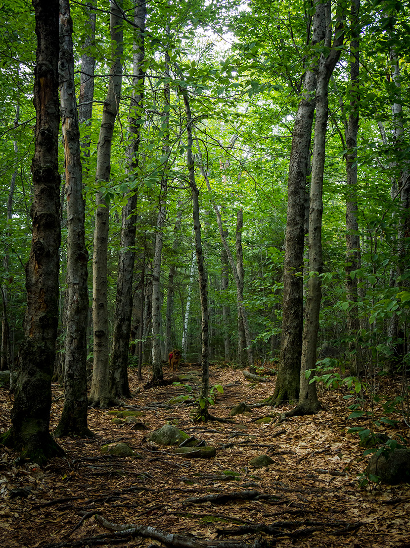
Although it was the 2nd day of fall according to the calendar, summer definitely had a hold of yesterday's forecast, and the clear, sunny skies and warm temperatures begged for us to get outside; so my wife, my pup, and I set out to a spot I actually stumbled upon a while back thanks to the
VisitNH Instagram page, Madame Sherri's Forest in Chesterfield, NH.
You can't get much more southwest in New Hampshire than Chesterfield. From Manchester, it was about an hour and half drive for us down to the town that butts up against the Connecticut River, the border between New Hampshire and Vermont. Before heading to the forest, we stopped at the
Chesterfield Gorge Natural Area to check out the cascades running through it as mentioned in the extremely thorough
New England Waterfalls book by Greg Parsons and Kate Watson. If you're interested in all the waterfalls New England has to offer, I highly recommend it.
 |
| A cascade along the Chesterfield Gorge |
The gorge was an easy 0.7-mile loop "hike" that was more of a nice warm up walk in the woods. It was mostly wide with easy footing with a couple quick ups and downs to get the legs going. Fencing on either side of the steeper parts of the gorge kept us from taking a tumble if we got close to the edge, but we were able to find a spot to carefully walk down next to the stream to get a couple photos of one the sections of cascades. Even with the stream not running at full strength, the cascades were still a beautiful way to start to our adventures, and our pup certainly enjoyed an early dip in the water!
From the gorge it was only about a fifteen minute drive down to the
Madame Sherri's Forest parking area. The main parking area was packed full (about 12 cars), but luckily there was more parking right across the street in an overflow area. We were worried from this that the trails would be more crowded than we expected, but we actually only ran into a handful of people the rest of the afternoon.
 |
| The famous staircase at Madame Sherri's mansion site |
We started our visit to the forest as most anyone does by making a stop at its most famous spot, the ruins of Madame Sherri's mansion. She was a famous costume designer in the 1920's known for throwing wild parties at her house in the woods. Her "castle" as she called it, burned down in 1962, but the stone foundation, some columns, and the most notable feature, a large spiral stone staircase, still remain. As we walked through the remains, we could only imagine how surreal this scene must have been when this house was full of people, music, and laughter. In fact–if you're one to believe in such things–people have said to have heard ghostly parties of the same sort going on at the ruins to this day, with some folks even saying they've seen the ghost of Madame Sherri ascending the stone staircase. A good biography of Madame Sherri, the mansion sight, and its ghostly folklore can be found
here.
 |
| What looked to be an old side entrance into the mansion |
Back to the hike review, we continued from the mansion site into the main trail network of the forest, starting with a wide easy trail with good soft footing up to the Ann Stokes Loop junction. We took the right/shorter 0.5-mile option up to Indian Pond, as we planned to watch the sunset from Wantastiquet Mountain that evening. From the junction to Island Pond trail rose with an easy side of moderate elevation gain. The trail was narrow in spots, but still fairly wide in most places up to the pond.
 |
| Start of the Ann Stokes Loop |
 |
| Panoramic view of Indian Pond |
Indian Pond was a lovely, quiet spot that we enjoyed all to ourselves. Our pup took several dips in it before we began the real climb of our trip up the Mine Ledge Trail to the summit of Wantastiquet Mountain. From the pond upward our climb got narrow and steep, with rough footing and rocks and roots all over. Luckily, this trail wasn't overgrown anywhere along the way so we never ran into any wayfinding issues. About halfway up the trail, dirt and roots gave way to a short rocky scramble reminiscent of climbing the big boulders above the treeline in the White Mountains, leading to a nice viewpoint looking east over Indian Pond and some smaller mountains in the vicinity.
 |
| One of several views along the Mine Ledge spur trail |
From this view point the trail was pretty steep for a short while longer before leveling off on a ridge with much better, softer footing heading up to the the spur trail to the Mine Ledge viewpoint. Seeing that we had time to fit it in, we took the quick descent down some rocks and onto the ledge to take in the views. Be warned that the "ledge" part was no lie, as we stepped onto the first outlook boulder and saw a straight drop below us! The summit of Wantastiquet dominated the view to our right, with more rolling hills stretching out from there. From the rocky end of the trail, we could see Mount Monadnock rising to the west above all the smaller summits in the region.
After taking in the Mine Ledge, we headed back on the ridge up to our main summit for the day. From where the spur trail departed up to the summit of Wantastiquet, the ridge was a rocky, rough roller coaster. There were several steep ups and downs on large rock slabs and rough boulders followed by treks through thick forest. Still, the trail, although narrow, wasn't overgrown anywhere along the way.
 |
| Sunset over Vermont from Wantastiquet north summit. Brattleboro, VT at the bottom |
Once on the south summit of Wantastiquet, noted by the communication tower on our left, we took the short walk a little further down a wide, old forest road to the lookout over the Connecticut River on the slightly smaller north summit of the mountain. Here, Brattleboro, VT was in the near foreground, with the rest of of Vermont's rolling hills and mountains stretching out into the distant horizon. We watched as the sun set directly in front of us, casting an array of colors over the mountains, town, and sky.
Madame Sherri's Forest definitely won us over yesterday. We left so much to explore, including the rest of the Anne Stokes Loop, nearby Daniels Mountain, and the trek up Wantastiquet from the other side of the mountain right next to the river. It is definitely a hidden gem tucked into a quiet corner of southwest New Hampshire. As we finished our hike in the dark, we heard the rustling and calls of all sorts of woodland creatures, and we passed back by the mansion ruins we did hear the sounds of music, growing ever more distinct, somewhere in the distance...from a house we would later see was right next to where we parked, haha!
A great map of the trails of forest can found at the SPNHF website
here.
Below is a breakdown of our hike:
- Start from Madame Sherri's mansion - 4:34 p.m.
- Indian Pond - 4:50 p.m.
- Mine Ledge viewpoint - 5:30 p.m.
- Wantastiquet summit - 6:05 p.m.
- Left Wantastiquet summit - 6:42 p.m.
- Back at car - 7:41 p.m.